
Ullscarf - Lake District Walk
Saturday 14th September 2013
We had sat on the side of Scar Crags yesterday assessing the descent on the route we had planned for today and I decided it might be too much for my knee, which was feeling sore. Instead we decided to adapt a route we had mapped out around Ullscarf to take in a gentler and hopefully easier descent. Just one slight miscalculation, in looking at the route we estimated it was about 5 or 6 miles and forgot to take account of the smaller scale of the map I had printed out and ended up with a longer day on the fells than we had planned on.
Start: Steel End car park (NY 3207 1293)
Route: Steel End car park - Harrop Tarn - Low Saddle on Coldbarrow Fell (377) - High Saddle on Coldbarrow Fell (378) - Ullscarf - Greenup Edge - The Bog - Wythburn Valley - Steel End car park
Distance: 8 miles Ascent: 643 metres Time Taken: 7 hours 50 mins
Terrain: A mixture of clear paths and pathless moorland.
Weather: Warm and sunny.
Pub Visited: Kings Head, Thirlspot Ale Drunk: Jennings Cumberland

After following the rather damp path to the left of Dobbs Gill we emerged at Harrop Tarn.

We had been anticipating being caught by runners as we climbed the path but fortunately the first of them passed us as we crossed the bridge.

After leaving the woods it was well worth turning around to admire the view towards Seat Sandal and Fairfield.

Reaching the gate we had out first view of Blea Tarn.

Fine views in every direction.
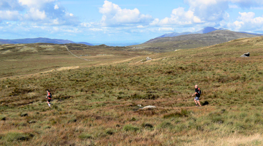
Just after we passed through the gate the main group of runners started to pass us. The three people who had passed us in the woods were about an hour ahead of this group.

A race marshal had been sat on Bell Crags earlier, looking out for the runners and as we walked towards the gate we had seen his shelter heading down the ridge.

Passing Blea Tarn we opted to get the next climb out of the way before stopping for lunch.

We were rewarded with a view of a trio of lakes.

A slightly closer view than the one we had during our lunch stop.

We were able to watch the runners as they skirted Blea Tarn and headed for High Seat.

A short climb after lunch brought us to the first summit of the day, Low Saddle on Coldbarrow Fell.

From here we were able to pick out yesterday's summits of Causey Pike and Scar Crags.

Another short walk would take us to High Saddle.

The small cairn that I have seen on other websites appears to have disappeared.

The final ascent of the day saw us reach Ullscarf. The last time we were here I had to kneel down to get a shot of the cairn in the wind and sleet and the cairn was the only thing visible. The views were much better today.

As we headed for Greenup Edge I diverted off the path for a shot across Wythburn.

After an easy stroll and gentle descent we reached Greenup Edge and headed down.

Looking down Wythburn from around the top of the area known as the bog.

After a much longer than expected walk down the valley the end is finally in sight. Needless to say ours was the only car in the car park. Unfortunately the descent from Greenup Edge to the car park proved to be too much for my right knee as I had put it under too much pressure trying to protect my left heel. The next few months were spent avoiding any descents and walking as I underwent a course of physio on both my knee and my heels.
All pictures copyright © Peak Walker 2006-2023